Search results

Map

Choose map: | | Download Centroids / Boundaries / Map (pdf)
Materials presented on this website, particularly maps and territorial information, are as-is and as-available based on available data and do not imply the expression of any opinion whatsoever on the part of the Secretariat of the Ramsar Convention concerning the legal status of any country, territory, city or area, or of its authorities, or concerning the delimitation of its frontiers or boundaries.

List

  1. Aerial view of Logan Lagoon looking north-west (17th July 2009).

    Logan Lagoon

    • Country: 
      Australia
    • Designation date: 
      16-11-1982
    • Site number: 
      252
    • Published since: 
      0 year(s)
    2,257 ha
  2. ---
    Interlaken (Lake Crescent) Ramsar site - Lake Crescent
    Interlaken (Lake Crescent) Ramsar site
    Interlaken (Lake Crescent) Ramsar site - Lake Crescent
    Interlaken Ramsar site interpretation sign

    Interlaken Lakeside Reserve

    • Country: 
      Australia
    • Designation date: 
      16-11-1982
    • Site number: 
      259
    • Published since: 
      0 year(s)
    517 ha
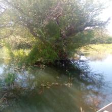
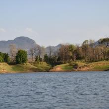
  3. Back water of Tawa Reservoir
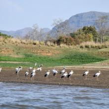
    Flock of Painted Stork, back water of Denwa river
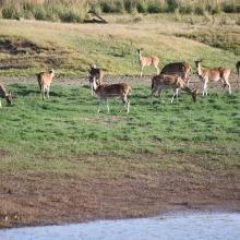
    Spotted dear in Tawa Reservoir, Satpura Tiger Reserve
    Nesting site of River Tern (Birds) in the small Island of Tawa

    Tawa Reservoir

    • Country: 
      India
    • Designation date: 
      08-01-2024
    • Site number: 
      2547
    • Published since: 
      0 year(s)
    20,050 ha
  4. Painted Stork with juvenile
    Therthangal Bird Sanctuary
    Open-billed Stork with juvenile
    Painted Stork roosting in the trees found in the wetland

    Therthangal Bird Sanctuary

    • Country: 
      India
    • Designation date: 
      15-07-2024
    • Site number: 
      2562
    • Published since: 
      0 year(s)
    29 ha
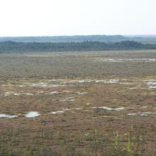
  5. Open part with bog pool labyrinths of Teici mire system. Unchanged, virgin state of ecosystem.
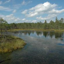
    One of hundred bog pools and small lakes occurring near margin of Teici mire close to forest belt.
    Cranberries - abundant within the nature reserve of Teici
    Cranberries - abundant within the nature reserve of Teici
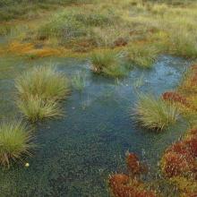
    Vegetation of bog hollow - Teici Mire.
    Small mineral ice-lands occurring within huge wetland complex increase biodiversity and provide shelter for birds and animals.
    Teici bog

    Teici and Pelecare bogs

    • Country: 
      Latvia
    • Designation date: 
      25-07-1995
    • Site number: 
      740
    • Published since: 
      0 year(s)
    25,469 ha
  6. Shells on Eighty-mile Beach
    Tidal shelf on Eighty-mile Beach
    Tidal stream at Eighty-mile Beach
    Sand dunes behind Eighty-mile Beach
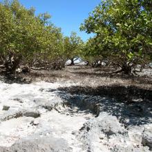
    Eighty-mile Beach - mangroves at low tide

    Eighty-mile Beach

    • Country: 
      Australia
    • Designation date: 
      07-06-1990
    • Site number: 
      480
    • Published since: 
      0 year(s)
    175,487 ha
  7. Coral Reef, Coral Sea. Photo by Australian Customs Service (date of image unknown).
    Lihou Reef, Coral Sea. Photo by Australian Customs Service (date of image unknown).
    Coral Sea Ramsar site sign. Photo by Parks Australia (date of image unknown).

    Coral Sea Reserves

    • Country: 
      Australia
    • Designation date: 
      21-10-2002
    • Site number: 
      1222
    • Published since: 
      0 year(s)
    1,728,920 ha
  8. Ramsar logo

    Osun-Oshogbo Sacred Grove

    • Country: 
      Nigeria
    • Designation date: 
      01-03-2024
    • Site number: 
      2563
    • Published since: 
      0 year(s)
    54 ha
  9. Bande de Dendrocygnes fauves au bord du lac Débo
    Forêt inondée à Acacia kirkii (Akagoun – Youwarou)
    Une vue du Delta Intérieur du fleuve Niger au Mali
    Limicoles
    Akagoun en étiage
    x
    x
    x
    x
    Tombouctou
    Poisson DIN
    les nénuphars du delta
    Acacia Kirkii
    Peuplement d'Acacia kirkii

    Delta Intérieur du Niger

    • Country: 
      Mali
    • Designation date: 
      01-02-2004
    • Site number: 
      1365
    • Published since: 
      0 year(s)
    4,119,500 ha

Pages

Stats


Exports

Export Sites information

For a summary list of all the Ramsar Sites in pdf format, click here.

Generate reports of selected Sites

You can generate a report based on the filters you have applied, in either pdf or xls format. The report will sort the results by the Site name, unless you have sorted them by another variable.

For the pdfs, you can choose whether to include the introductory text on each Site, or just show the key data in a shorter report.

To receive a report, please provide your email address and enter the text in the verification picture into the textbox.

As soon as the list has been generated an e-mail will be sent to you with the link to access the file.