Search results

Map

Choose map: | | Download Centroids / Boundaries / Map (pdf)
Materials presented on this website, particularly maps and territorial information, are as-is and as-available based on available data and do not imply the expression of any opinion whatsoever on the part of the Secretariat of the Ramsar Convention concerning the legal status of any country, territory, city or area, or of its authorities, or concerning the delimitation of its frontiers or boundaries.

List

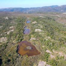
  1. Vue aérienne de la Réserve Naturelle des Tre Padule de Suartone
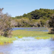
    Vue de la mare de Tre Padule Est
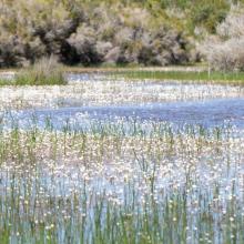
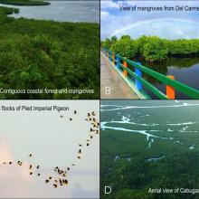
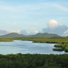
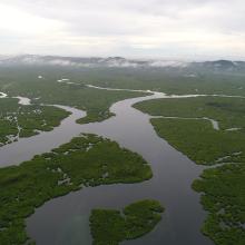
    Vue de Ranunculus peltatus au premier plan de la mare de Padule Maggiore
    Vue du plateau de Campu celi et de trois mares temporaires de la réserve naturelle
    Mare de Tre Padule Est en phase inondée
    Vue aérienne des Tre Paduli
    Ruisseau temporaire de Campu Celi
    Mare de Tre Padule Est au printemps
    Végétation de la mare en phase inondée
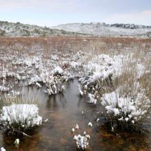
    Mare de Tre Padule Est en hiver
    Padule Maggiore sous la neige

    Mares temporaires de Tre Padule de Suartone

    • Country: 
      France
    • Designation date: 
      02-02-2007
    • Site number: 
      1651
    • Published since: 
      2 year(s)
    218 ha
  2. Sasarawichi sand dunes
    The Tera Cora area has xeric landscapes and mudflats which transform yearly into a seasonal wetland. The name Tera Cora translates to Red Sand and refers to the icon red soil which covers the entire expanse.
    The roughed northwestern tip of Aruba.
    West Point and Arashi beach

    West Point

    • Country: 
      Netherlands (Kingdom of the) (Aruba)
    • Designation date: 
      10-11-2023
    • Site number: 
      2527
    • Published since: 
      1 year(s)
    2,185 ha
  3. Oiseaux d'eau
    Une vue de la plaine de Sourou
    x
    Oiseaux d’eau du Sourou
    Peuplement pur de Mytragina inermis
    Peuplement pur d’Anogeissus leiocarpus
    Des hippoptames
    Une vue de la plaine de Sourou
    Crocodiles du Sourou

    Plaine Inondable du Sourou

    • Country: 
      Mali
    • Designation date: 
      22-03-2013
    • Site number: 
      2128
    • Published since: 
      0 year(s)
    56,500 ha
  4. The San Nicolas Bay Reef islands in the back are breeding habitat for thousands of terns from 10 species.
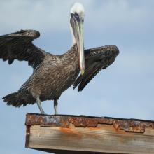
    Brown Pelican at San Nicolas Bay
    One of the turtle nesting beaches in front and the harbour area at San Nicolas in the back.
    Caribbean Blue Tang (Acanthurus coeruleus) and Black sea rod (Plexaura homomalla).
    Queen conch (Strombus gigas)
    Cayenne tern (Thalasseus eurygnathus and Cabot's tern (Thalasseus acuflavidus).
    Cayenne tern (Thalasseus eurygnathus.
    Green turtle (Chelonia mydas).
    Fresh water pond Fontein.

    East Point

    • Country: 
      Netherlands (Kingdom of the) (Aruba)
    • Designation date: 
      10-11-2023
    • Site number: 
      2525
    • Published since: 
      1 year(s)
    7,597 ha
  5. Information panel near the canal that connects Bubali Wetlands with the Caribbean Sea in the southwest of the site. The invasive water hyacinth can be seen in the background.
    The Bubali Wetlands are an oasis between urban areas and high rise hotels.
    Juvenile Little Blue Heron at Bubali Wetlands (Egretta caerulea).
    Roseate Spoonbill (Platalea ajaja)
    White Cheecked Pintails (Anas bahamensis)
    Black Skimmers
    Whimbrels (Numenius phaeopus)
    Shorebirds
    Great White Egrets (Ardea alba)
    The Bubali Wetlands are an oasis between urban areas and high rise hotels.
    Salina Cerca
    Salina Cerca
    Salina Druif
    Salina Malmok
    Salina Malmok
    Salina Palm Beach

    Western Wetlands

    • Country: 
      Netherlands (Kingdom of the) (Aruba)
    • Designation date: 
      10-11-2023
    • Site number: 
      2528
    • Published since: 
      1 year(s)
    392 ha
  6. Rules and regulations at the entrance of one of the site's beaches.
    The site encompasses Aruba's largest stand of mangrove forest.
    The tangle of mangrove trees and branches protects the coast from extreme weather events.
    One of the islets that is part of a chain of islands in front of the coast.
    Elhorn coral) Acropora palmata)
    Honeycomb cowfish (Acanthostracion polygonius) in sea grass beds (Thalassia testudinum and Zyringodium filiforme).
    False killer-whale (Pseudorca crassidens).
    The Atlantic spotted dolphin (Stenella frontalis) uses the site for refuge, birthing and nursery.
    The Rough-toothed dolphin (Steno bredanensis) uses the site for refuge, birthing and nursery.
    Several dolphin species, like Tursiops truncatus, can be observed close to the coast.

    South Coast

    • Country: 
      Netherlands (Kingdom of the) (Aruba)
    • Designation date: 
      10-11-2023
    • Site number: 
      2526
    • Published since: 
      1 year(s)
    3,975 ha
  7. Aerial view of the contiguous Del Carmen Mangrove Forest
    (A, B) Poblacion boardwalk and view deck overlooking the contiguous coastal forests and mangroves of Domoyog and Esperanza, which are vital roosting sites for the (C) Pied Imperial Pigeon, or (D) taking a boat tour through the vast network of channels that course between the mangeroves (Photo by JC
    Del Carmen Mangrove Forest

    Del Carmen Mangrove Reserve (DCMR) in Siargao Island Protected Landscape and Seascape (SIPLAS)

    • Country: 
      Philippines
    • Designation date: 
      08-01-2024
    • Site number: 
      2553
    • Published since: 
      0 year(s)
    8,654 ha
  8. Acrocephalus paludicola
    Egretta alba
    Cypripedium calceolus
    Lake Liubyaz
    Removal of problematic vegetation on the Pripyat River
    Spring concentration of migrated water birds
    Swamp renaturalization in the key habitat of aquatic warbler

    Prypiat River Floodplains

    • Country: 
      Ukraine
    • Designation date: 
      28-02-1997
    • Site number: 
      776
    • Published since: 
      3 year(s)
    37,568 ha
  9. Zones humides, forêts, Rivières et ressources du site

    Ngiri-Tumba-Maindombe

    • Country: 
      Democratic Republic of the Congo
    • Designation date: 
      24-07-2008
    • Site number: 
      1784
    • Published since: 
      8 year(s)
    6,569,624 ha
  10. Flocks of birds at Tuckerbil Swamp near Leeton
    Brolgas at Tuckerbil Swamp
    Wading birds at Fivebough Swamp
    Reed vegetation at Tuckerbil Swamp
    Reed vegetation at Fivebough Swamp

    Fivebough and Tuckerbil Swamps

    • Country: 
      Australia
    • Designation date: 
      21-10-2002
    • Site number: 
      1224
    • Published since: 
      0 year(s)
    619 ha

Pages

Stats


Exports

Export Sites information

For a summary list of all the Ramsar Sites in pdf format, click here.

Generate reports of selected Sites

You can generate a report based on the filters you have applied, in either pdf or xls format. The report will sort the results by the Site name, unless you have sorted them by another variable.

For the pdfs, you can choose whether to include the introductory text on each Site, or just show the key data in a shorter report.

To receive a report, please provide your email address and enter the text in the verification picture into the textbox.

As soon as the list has been generated an e-mail will be sent to you with the link to access the file.