Search results

Map

Choose map: | | Download Centroids / Boundaries / Map (pdf)
Materials presented on this website, particularly maps and territorial information, are as-is and as-available based on available data and do not imply the expression of any opinion whatsoever on the part of the Secretariat of the Ramsar Convention concerning the legal status of any country, territory, city or area, or of its authorities, or concerning the delimitation of its frontiers or boundaries.

List

  1. Elbeaue Bölsdorf

    Aland-Elbe-Lowland and Elbe-wetland Jerichow

    • Country: 
      Germany
    • Designation date: 
      21-02-2003
    • Site number: 
      1307
    • Published since: 
      1 year(s)
    8,605 ha
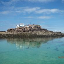
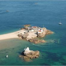
  2. General view of Les Écrehous & Les Dirouilles Ramsar Site, Jersey
    View of La Marmotière, one of four rocky heads within Les Écrehous & Les Dirouilles Ramsar Site that are large enough to support buildings
    Aerial view of La Marmotière, one of four rocky heads within Les Écrehous & Les Dirouilles Ramsar Site that are large enough to support buildings

    Les Écréhous & Les Dirouilles, Jersey

    • Country: 
      United Kingdom of Great Britain and Northern Ireland (Crown dependencies)
    • Designation date: 
      02-02-2005
    • Site number: 
      1455
    • Published since: 
      1 year(s)
    5,459 ha
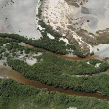
  3. Mangroves near Shannah
    Mangroves near Shannah
    Intertidal mudflats near Shannah
    Mahout Island
    Filim salt flat
    Kinasah lagoon
    Abb Island
    Kinasah lagoon
    Intertidal mudflats

    Wetlands Reserve in Al Wusta Governorate

    • Country: 
      Oman
    • Designation date: 
      25-10-2023
    • Site number: 
      2529
    • Published since: 
      1 year(s)
    213,715 ha
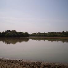
  4. Muni Lagoon
    Muni Lagoon
    Muni Lagoon
    Muni Lagoon

    Muni-Pomadze Ramsar Site

    • Country: 
      Ghana
    • Designation date: 
      14-08-1992
    • Site number: 
      563
    • Published since: 
      1 year(s)
    9,461 ha
  5. Pirogues traditionnelles au lac Wegnia
    Comité des villageois, gestion du lac Wegnia
    Parcelle de mise en defens
    Lac Wegnia en étiage
    Poissons du lac Wegnia
    Barrage artisanale de retenue
    Végétation du lac Wegnia
    Vue de la partie Ouest du lac Wegnia
    Formation pour la lutte contre l'érosion
    Lutte contre le ravinement
    forêt de Mytragina inermis
    Ravinement du bassin versant
    Champ sur des terres adjacentes

    Lac Wegnia

    • Country: 
      Mali
    • Designation date: 
      22-03-2013
    • Site number: 
      2127
    • Published since: 
      0 year(s)
    3,900 ha
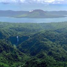
  6. Lake Letas, Gaua Island, Vanuatu
    Lusal River, Gaua Island, Vanuatu
    No Tilapia Sign Board, Lake Letas, Gaua Island, Vanuatu
    Lake Letes + Siri Waterfall

    Lake Letes

    • Country: 
      Vanuatu
    • Designation date: 
      15-09-2023
    • Site number: 
      2524
    • Published since: 
      1 year(s)
    8,248 ha
  7. Oiseaux d'eau
    Une vue de la plaine de Sourou
    x
    Oiseaux d’eau du Sourou
    Peuplement pur de Mytragina inermis
    Peuplement pur d’Anogeissus leiocarpus
    Des hippoptames
    Une vue de la plaine de Sourou
    Crocodiles du Sourou

    Plaine Inondable du Sourou

    • Country: 
      Mali
    • Designation date: 
      22-03-2013
    • Site number: 
      2128
    • Published since: 
      0 year(s)
    56,500 ha
  8. Northeast part of the lake. Open water, green algae and diving duck species are visible.
    waterbird habitat in Pyu Lake
    waterbird habitat in Pyu Lake
    Eastern part of Pyu Lake during dry season. Open water with algae and tall grasses are visible.
    Southern part of the Lake during rainy season
    Southern part of the Lake. Stands of reed mace and tall grasses with few waterbirds are visible.
    Northern part of the Lake. Open water with green algae visible.
    East to west part of the Lake Visible. Area with open water where villagers bathe and wash clothes during dry season.

    Pyu Lake

    • Country: 
      Myanmar
    • Designation date: 
      02-02-2024
    • Site number: 
      2533
    • Published since: 
      1 year(s)
    234 ha
  9. The San Nicolas Bay Reef islands in the back are breeding habitat for thousands of terns from 10 species.
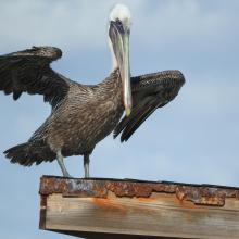
    Brown Pelican at San Nicolas Bay
    One of the turtle nesting beaches in front and the harbour area at San Nicolas in the back.
    Caribbean Blue Tang (Acanthurus coeruleus) and Black sea rod (Plexaura homomalla).
    Queen conch (Strombus gigas)
    Cayenne tern (Thalasseus eurygnathus and Cabot's tern (Thalasseus acuflavidus).
    Cayenne tern (Thalasseus eurygnathus.
    Green turtle (Chelonia mydas).
    Fresh water pond Fontein.

    East Point

    • Country: 
      Netherlands (Kingdom of the) (Aruba)
    • Designation date: 
      10-11-2023
    • Site number: 
      2525
    • Published since: 
      1 year(s)
    7,597 ha
  10. Aruban Burrowing Owl (Athene cunicularia arubensis) in front of its nest at Spaans Lagoen
    Juvenile Tricolored Heron (Egretta tricolor) at Spaans Lagoen.
    Lesser Yellowlegs (Tringa flavipes) at Spaans Lagoen.
    Regrowth of mangrove trees under the bridge which was constructed in 2016.
    Spaans Lagoen landscape
    The Spaans Lagoen wetland area with its desert scrub water catchment area in the back.
    English language information panel informing tourists about the rules and regulations at Ramsar site Spaans Lagoen.

    Spanish Lagoon

    • Country: 
      Netherlands (Kingdom of the) (Aruba)
    • Designation date: 
      23-05-1980
    • Site number: 
      198
    • Published since: 
      1 year(s)
    259 ha

Pages

Stats


Exports

Export Sites information

For a summary list of all the Ramsar Sites in pdf format, click here.

Generate reports of selected Sites

You can generate a report based on the filters you have applied, in either pdf or xls format. The report will sort the results by the Site name, unless you have sorted them by another variable.

For the pdfs, you can choose whether to include the introductory text on each Site, or just show the key data in a shorter report.

To receive a report, please provide your email address and enter the text in the verification picture into the textbox.

As soon as the list has been generated an e-mail will be sent to you with the link to access the file.