Search results

Map

Choose map: | | Download Centroids / Boundaries / Map (pdf)
Materials presented on this website, particularly maps and territorial information, are as-is and as-available based on available data and do not imply the expression of any opinion whatsoever on the part of the Secretariat of the Ramsar Convention concerning the legal status of any country, territory, city or area, or of its authorities, or concerning the delimitation of its frontiers or boundaries.

List

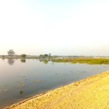
  1. Northeast part of the lake. Open water, green algae and diving duck species are visible.
    waterbird habitat in Pyu Lake
    waterbird habitat in Pyu Lake
    Eastern part of Pyu Lake during dry season. Open water with algae and tall grasses are visible.
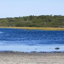
    Southern part of the Lake during rainy season
    Southern part of the Lake. Stands of reed mace and tall grasses with few waterbirds are visible.
    Northern part of the Lake. Open water with green algae visible.
    East to west part of the Lake Visible. Area with open water where villagers bathe and wash clothes during dry season.

    Pyu Lake

    • Country: 
      Myanmar
    • Designation date: 
      02-02-2024
    • Site number: 
      2533
    • Published since: 
      1 year(s)
    234 ha
  2. North of lake Ammersee with Ampermoos
    South of lake Ammersee with the Natura 2000 area "Ammersee south shore and Raistinger meadows" and the nature reserve "Vogelfreistätte Ammersee Süd"
    View from the observation site at the western dike of the new Ammer across the so-called Binnensee to the Dießen Minster. Core area for wetland birds with shallow water zones, reed beds and a nesting raft for Common Terns. In the foreground, siltation zone resulting from the bursting of a dam at the
    Downstream area dammed by a beaver in the Ampermoos, the large river valley fen north of Lake Ammer

    Lake Ammer

    • Country: 
      Germany
    • Designation date: 
      26-02-1976
    • Site number: 
      93
    • Published since: 
      1 year(s)
    6,386 ha
  3. Bar headed goose in Magadi kere wetland
    Panoramic view of Magadi kere
    Panoramic view of Magadi kere

    Magadi Kere Conservation Reserve

    • Country: 
      India
    • Designation date: 
      14-02-2023
    • Site number: 
      2536
    • Published since: 
      1 year(s)
    54 ha
  4. Aerial view of Møsvasstangen

    Møsvasstangen

    • Country: 
      Norway
    • Designation date: 
      18-03-1996
    • Site number: 
      803
    • Published since: 
      2 year(s)
    1,441 ha
  5. The Ramsar listed wetland of Jocks Lagoon near St Helens in Tasmania
    The Ramsar listed wetland of Jocks Lagoon near St Helens in Tasmania
    The Ramsar listed wetland of Jocks Lagoon near St Helens in Tasmania
    The Ramsar listed wetland of Jocks Lagoon near St Helens in Tasmania

    Jocks Lagoon

    • Country: 
      Australia
    • Designation date: 
      16-11-1982
    • Site number: 
      258
    • Published since: 
      0 year(s)
    19 ha
  6. View looking Northeast across Lover’s Lake

    Lover's Lake Nature Reserve

    • Country: 
      United Kingdom of Great Britain and Northern Ireland (Overseas territories)
    • Designation date: 
      11-05-1999
    • Site number: 
      989
    • Published since: 
      1 year(s)
    2 ha
  7. Oasis du Tafilalet
    Oasis du Tafilalet
    Oasis du Tafilalet

    Oasis du Tafilalet

    • Country: 
      Morocco
    • Designation date: 
      15-01-2005
    • Site number: 
      1483
    • Published since: 
      0 year(s)
    15,300 ha
  8. Shellfishes
    Waterbirds
    Mangroves
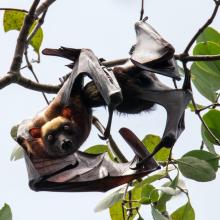
    Nursing Acerodon jubatus
    Roosting site of flying fox in Siay, Sibugay - host to the largest flying fox roost in the Philippines. Mix roost of Acerodon jubatus, Pteropus vampyrus & Pteropus hypomelanus.
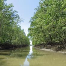
    Mangroves at Talusan area -protecting the community and supporting their fishery needs.
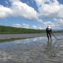
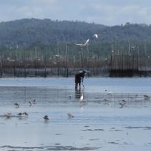
    Vast Mudflat of Sibugay Wetland Nature Reserve
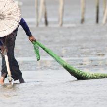
    Shell gathering - a typical activity of the local community during low tide.
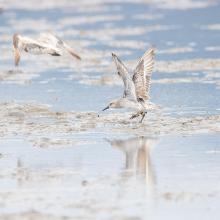
    Great Knot with 4TW inscription on yellow flag banded banded in Roebuck Bay, North-West Australia
    First reported resighting of Red Knot with AC inscription on yellow flag banded in Chongming Dao, Shanghai, China on April 18, 2014. Documented in the wetland from 2018-2022.
    Red-necked Stint banded at Komuke marsh, Koguchi, Kumanoue, Monbetsu, Hokkaido pref., Japan
    Ruddy Turnstone with J8 inscription on white flag was banded at Han Pao, Changhwa County, Taiwan on August 7, 2018. Resighted in Sibugay Wetland Nature Reserve from 2018-2021.
    Collage photos of SWNR at your service

    Sibugay Wetland Nature Reserve

    • Country: 
      Philippines
    • Designation date: 
      08-01-2024
    • Site number: 
      2552
    • Published since: 
      0 year(s)
    175,551 ha
  9. Lake Julturbas
    reed beds on the lake Julturbas
    fishermen on the lake Julturbas

    Lake Julturbas

    • Country: 
      Uzbekistan
    • Designation date: 
      08-08-2022
    • Site number: 
      2541
    • Published since: 
      1 year(s)
    64,715 ha
  10. Qualifying bird species Gentoo Penguin Pygoscelis papua
    Qualifying bird species Kelp Goose Chloephaga hybrida malvinarum
    Qualifying bird species the endemic Falkland Steamer Duck Tachyeres brachydactyla
    Qualifying bird species Tussac Bird (Blackish Cinclodes) Cinclodes antarcticus antarcticus
    Qualifying mammal species South American Sea Lion Otaria flavescens (pup shown)
    Qualifying plant species Coastal Nassauvia Nassauvia gaudichaudii
    Qualifying plant species Silvery Buttercup Hamadryas argentea
    Qualifying plant species Smooth Ragwort Senecio vaginatus
    Wetland Type A - shallow marine waters with Commerson's Dolphin Cephalorhynchus commersonii
    Wetland Type D - intertidal rocky shore with resting South American tern Sterna hirundinacea
    Wetland Type E - low sand dunes with feeding White-rumped sandpiper Calidris fuscicollis
    Wetland Type J - Coastal Brackish Lagoon
    Wetland Types A & E - shallow marine waters and pebble shores

    Bertha's Beach

    • Country: 
      United Kingdom of Great Britain and Northern Ireland (Overseas territories)
    • Designation date: 
      24-09-2001
    • Site number: 
      1103
    • Published since: 
      1 year(s)
    3,000 ha

Pages

Stats


Exports

Export Sites information

For a summary list of all the Ramsar Sites in pdf format, click here.

Generate reports of selected Sites

You can generate a report based on the filters you have applied, in either pdf or xls format. The report will sort the results by the Site name, unless you have sorted them by another variable.

For the pdfs, you can choose whether to include the introductory text on each Site, or just show the key data in a shorter report.

To receive a report, please provide your email address and enter the text in the verification picture into the textbox.

As soon as the list has been generated an e-mail will be sent to you with the link to access the file.