Search results

Map

Choose map: | | Download Centroids / Boundaries / Map (pdf)
Materials presented on this website, particularly maps and territorial information, are as-is and as-available based on available data and do not imply the expression of any opinion whatsoever on the part of the Secretariat of the Ramsar Convention concerning the legal status of any country, territory, city or area, or of its authorities, or concerning the delimitation of its frontiers or boundaries.

List

  1. Vallée de la Somme à l'aval d'Amiens
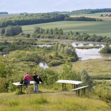
    Etangs de la Haute Somme depuis les hauteurs de Frise
    Vallée de la Somme et canal entre Amiens et Abbeville
    Belvédère de Frise au dessus des étangs de la Haute Somme
    Etangs et belvédère de Cléry/Somme

    Marais et tourbières des vallées de la Somme et de l’Avre

    • Country: 
      France
    • Designation date: 
      18-12-2017
    • Site number: 
      2322
    • Published since: 
      0 year(s)
    13,140 ha
  2. Lake Naivasha
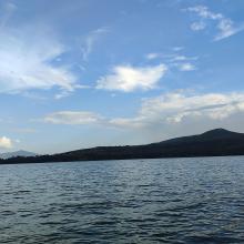
    Lake Naivasha
    Lake Naivasha

    Lake Naivasha

    • Country: 
      Kenya
    • Designation date: 
      10-04-1995
    • Site number: 
      724
    • Published since: 
      1 year(s)
    30,000 ha
  3. Untere Havel

    Lowland of the lower Havel/Gülper Lake/Schollener Lake

    • Country: 
      Germany
    • Designation date: 
      31-07-1978
    • Site number: 
      173
    • Published since: 
      0 year(s)
    8,920 ha
  4. X
    Hyphaene palm grove at Shakako, Tana Delta by Peter Usher
    Livestock grazing Dide Waride, Tana Delta by John Mwacharo
    Tana River banks with mangroves at Kipini by Peter Usher

    Tana River Delta Ramsar Site

    • Country: 
      Kenya
    • Designation date: 
      09-07-2012
    • Site number: 
      2082
    • Published since: 
      1 year(s)
    163,600 ha
  5. panoramic view of the Pyeongdume Wetland
    close-range view of flat-head Pyeongdume wetland

    Pyeongdume Wetland

    • Country: 
      Republic of Korea
    • Designation date: 
      13-05-2024
    • Site number: 
      2544
    • Published since: 
      1 year(s)
    2 ha
  6. Lac d'Ambléon
    Marais de Vaux et son sentier sur pilotis
    Marais de Vaux et son sentier sur pilotis
    Marais de Vaux et son sentier sur pilotis
    Tourbière de Cerin
    Combe de Léchaud
    Marais de Sainte Blaizine
    Marais en Jarine
    Marais de Léchères et Teppes
    Marais en Jarine - narcisses
    Etangs de Genevray
    Zones humides de Thézillieu - Salers
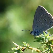
    Azuré de la Croisette - zones humides de Thézillieu
    Crapaud commun - crapauduc temporaire à Thézillieu
    Drosera à feuilles rondes - zones humides de Brénod
    Linaigrette - Combe de Cerin
    Tourbière de la Béroude

    Marais et tourbières des montagnes du Bugey

    • Country: 
      France
    • Designation date: 
      22-03-2024
    • Site number: 
      2542
    • Published since: 
      1 year(s)
    1,050 ha
  7. Landscape image of Nanjarayan Bird Sanctuary
    Image of Heronry in Nanjarayan Bird Sanctuary
    Oriental Darter nesting in the Heronry of Nanjarayan Bird Sanctuary
    mage of Heronry in Nanjarayan Bird Sanctuary
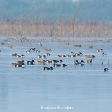
    Flock of Northern shoveler resting in Nanjarayan Bird Sanctuary
    Flock of Cormorant resting in Nanjarayan Bird Sanctuary
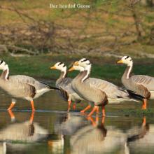
    Flock of Bar-headed Goose resting in Nanjarayan Bird Sanctuary
    Flock of Bar-headed Goose resting in Nanjarayan Bird Sanctuary
    Flock of Spot-billed Pelican and Cormorant foraging in Nanjarayan Bird Sanctuary
    Flock of Juvenile Spot-billed Pelican resting in Nanjarayan Bird Sanctuary
    Aerial view of Nanjarayan Bird Sanctuary
    Ruddy Shelduck in Nanjarayan Bird Sanctuary
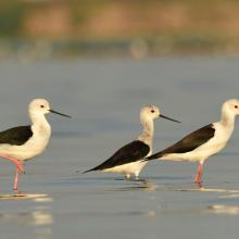
    Black-winged Stilt in Nanjarayan Bird Sanctuary
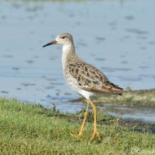
    Ruff in Nanjarayan Bird Sanctuary
    Flock of Northern shoveler resting in Nanjarayan Bird Sanctuary

    Nanjarayan Bird Sanctuary

    • Country: 
      India
    • Designation date: 
      16-01-2024
    • Site number: 
      2549
    • Published since: 
      0 year(s)
    126 ha
  8. Looking west over Spittal Pond
    Looking south across Spittal Pond to the sea

    Spittal Pond

    • Country: 
      United Kingdom of Great Britain and Northern Ireland (Overseas territories)
    • Designation date: 
      11-05-1999
    • Site number: 
      984
    • Published since: 
      1 year(s)
    10 ha
  9. Reed field by Utonai-ko
    Snowshoe hiking at World Wetlands Day
    Utonai-ko
    Winter at Utonai-ko
    Greater White-fronted Goose flying over Utonai-ko

    Utonai-ko

    • Country: 
      Japan
    • Designation date: 
      12-12-1991
    • Site number: 
      539
    • Published since: 
      1 year(s)
    510 ha
  10. inséré le 27 juin 2016
    inséré le 27 juin 2016
    inséré le 27 juin 2016
    inséré le 27 juin 2016
    inséré le 27 juin 2016

    Chute du Fleuve Ivindo

    • Country: 
      Gabon
    • Designation date: 
      02-02-2009
    • Site number: 
      1852
    • Published since: 
      0 year(s)
    103,334 ha

Pages

Stats


Exports

Export Sites information

For a summary list of all the Ramsar Sites in pdf format, click here.

Generate reports of selected Sites

You can generate a report based on the filters you have applied, in either pdf or xls format. The report will sort the results by the Site name, unless you have sorted them by another variable.

For the pdfs, you can choose whether to include the introductory text on each Site, or just show the key data in a shorter report.

To receive a report, please provide your email address and enter the text in the verification picture into the textbox.

As soon as the list has been generated an e-mail will be sent to you with the link to access the file.