Résultats de la recherche

Carte

Choisir carte: | | Téléchargement Centroids / Boundaries / Carte (pdf)
Le matériel présenté sur ce site web, et en particulier les cartes et l’information territoriale, est tel qu’il apparaît dans les données disponibles et n’implique en aucune manière l’expression d’une opinion quelconque de la part du Secrétariat de la Convention de Ramsar concernant le statut juridique de tout pays, territoire, ville ou zone, ou de ses autorités, ou concernant la délimitation de ses frontières ou limites.

Liste

  1. Typical reservoir of the site Unterer Inn with the different stages of succession to alluvial forests
    Extensive redynamisation measures are currently underway on the Lower Inn. At the Ering power plant, for example, reinforced river embankments were removed in recent years and a new island tributary system with shallow gravel banks was created.
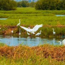
    Numerous migratory birds rest on the mudflats and shallow siltation zones in the reservoirs on the Lower Inn, especially in autumn, to replenish their reserves before embarking on their strenuous flight over the Alps (here in the background).

    Lower Inn between Haiming and Neuhaus

    • Pays: 
      Allemagne
    • Date d’inscription: 
      26-02-1976
    • Numéro du site: 
      96
    • Publié depuis: 
      0 year(s)
    1'846 ha
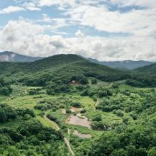
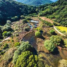
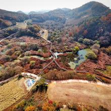
  2. Mungyeong Doline Wetland formed in a doline area, which is rare for wetlands
    Mungyeong Doline Wetland with colorful rice paddy
    Mungyeong Doline Wetland with colorful trees in autumn

    Mungyeong Doline Wetland

    • Pays: 
      République de Corée
    • Date d’inscription: 
      02-02-2024
    • Numéro du site: 
      2540
    • Publié depuis: 
      1 year(s)
    49 ha
  3. Marais salants du Mès
    Marais amont du Mès
    Marais salants de Guérande
    Marais salants du Mès

    Marais salants de Guérande et du Mès

    • Pays: 
      France
    • Date d’inscription: 
      01-09-1995
    • Numéro du site: 
      746
    • Publié depuis: 
      2 year(s)
    5'043 ha
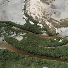
  4. Aerial view of the Pitt Water-Orielton Lagoon Ramsar Site. Photo by Jim Mollison. Date unknown.
    Orielton Lagoon Nature Reserve, Sorell Tasmania. Photo by Michelle McAulay. Date unknown.
    Pitt Water, near MC Gees Bridge. Photo by Michelle McAulay. Date unknown.

    Pitt Water-Orielton Lagoon

    • Pays: 
      Australie
    • Date d’inscription: 
      16-11-1982
    • Numéro du site: 
      254
    • Publié depuis: 
      1 year(s)
    3'334 ha
  5. Densu delta picture
    Densu delta picture
    Densu delta picture
    Picture of birds
    Densu River with mangrove stands along river banks
    Drying up salt pans
    Flood plains
    Fish caught from Densu River by local fishermen
    Canoe for fishing on river banks
    Red Mangrove stand in river
    Black heron fishing for prey

    Densu Delta Ramsar Site

    • Pays: 
      Ghana
    • Date d’inscription: 
      14-08-1992
    • Numéro du site: 
      564
    • Publié depuis: 
      1 year(s)
    5'893 ha
  6. Sasarawichi sand dunes
    The Tera Cora area has xeric landscapes and mudflats which transform yearly into a seasonal wetland. The name Tera Cora translates to Red Sand and refers to the icon red soil which covers the entire expanse.
    The roughed northwestern tip of Aruba.
    West Point and Arashi beach

    West Point

    • Pays: 
      Pays-Bas (Royaume des) (Aruba)
    • Date d’inscription: 
      10-11-2023
    • Numéro du site: 
      2527
    • Publié depuis: 
      1 year(s)
    2'185 ha
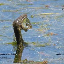
  7. Natrix tessellata hunting fish in Gandoman wetland
    Gandoman Wetland
    Phoenicopterus roseus in Gandoman wetland
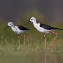
    Himantopus himantopus in Gandoman wetland
    Phalacrocorax carbo in Gandoman wetland
    Vanellus spinosus in Gandoman wetland
    Ardeola ralloides in Gandoman wetland
    Egretta garzetta in Gandoman wetland.
    Himantopus himantopus in Gandoman wetland.
    Podiceps nigricollis in Gandoman wetland.
    Fire Fighting station and Ranger station in Gandoman wetland.
    Bird watching tower in Gandoman wetland.
    Online Surveillance Camera in Gandoman wetland.
    Fulica atra in Gandoman wetland.
    Ciconia ciconia in Gandoman wetland.

    Gandoman

    • Pays: 
      Iran (République islamique d')
    • Date d’inscription: 
      21-07-2024
    • Numéro du site: 
      2558
    • Publié depuis: 
      0 year(s)
    1'070 ha
  8. Delta of the river Ache in nature protection area of lake Chiemsee
    Lake Chiemsee
    View from the village of „Übersee“ and the half-island „Lachsgang“ to north-east in direction of the protected area „Achendelta“.
    View from the village of „Übersee“ and the half-island „Lachsgang“ to north-east in direction of the protected area „Achendelta“.

    Lake Chiemsee

    • Pays: 
      Allemagne
    • Date d’inscription: 
      26-02-1976
    • Numéro du site: 
      95
    • Publié depuis: 
      1 year(s)
    8'231 ha
  9. Owabi Wildlife Sanctuary and Ramsar Site
    Owabi Wildlife Sanctuary and Ramsar Site
    Owabi Wildlife Sanctuary and Ramsar Site
    Owabi Wildlife Sanctuary and Ramsar Site
    Owabi Wildlife Sanctuary and Ramsar Site
    Owabi Wildlife Sanctuary and Ramsar Site

    Owabi Wildlife Sanctuary Ramsar Site

    • Pays: 
      Ghana
    • Date d’inscription: 
      22-02-1988
    • Numéro du site: 
      393
    • Publié depuis: 
      1 year(s)
    1'310 ha
  10. Mangroves near Shannah
    Mangroves near Shannah
    Intertidal mudflats near Shannah
    Mahout Island
    Filim salt flat
    Kinasah lagoon
    Abb Island
    Kinasah lagoon
    Intertidal mudflats

    Wetlands Reserve in Al Wusta Governorate

    • Pays: 
      Oman
    • Date d’inscription: 
      25-10-2023
    • Numéro du site: 
      2529
    • Publié depuis: 
      1 year(s)
    213'715 ha

Pages

Stats


Exports

Exportation d’informations sur les Sites Ramsar

Pour une liste résumée de tous les Sites Ramsar en format pdf, cliquez ici.

Générer des rapports sur un choix de Sites Ramsar

Vous pouvez générer un rapport à partir des filtres choisis, soit en pdf, soit en xls. Le rapport classera les résultats par noms de sites à moins que vous n’ayez choisi une autre variable de tri.

Pour les pdf, vous pouvez choisir d’inclure le texte d’introduction de chaque site ou seulement les données principales dans un rapport plus court.

Afin de recevoir la liste des sites Ramsar que vous avez sélectionnés, veuillez SVP nous fournir votre courriel et entrer le texte que vous voyez dans l'image de vérification dans la zone de texte.

Une foi la liste créée, un courriel vous sera envoyé contenant le lien pour accéder au fichier. Cela ne devrait pas prendre plus de 10 minutes.