Résultats de la recherche

Carte

Choisir carte: | | Téléchargement Centroids / Boundaries / Carte (pdf)
Le matériel présenté sur ce site web, et en particulier les cartes et l’information territoriale, est tel qu’il apparaît dans les données disponibles et n’implique en aucune manière l’expression d’une opinion quelconque de la part du Secrétariat de la Convention de Ramsar concernant le statut juridique de tout pays, territoire, ville ou zone, ou de ses autorités, ou concernant la délimitation de ses frontières ou limites.

Liste

  1. Ramsar logo

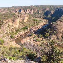
    Iron Gates Natural Park

    • Pays: 
      Roumanie
    • Date d’inscription: 
      05-03-2009
    • Numéro du site: 
      1946
    • Publié depuis: 
      14 year(s)
    115'666 ha
  2. View of the lake
    Cercopithecus mona
    Malimbus ibadanensis

    International Institute of Tropical Agriculture (IITA)

    • Pays: 
      Nigéria
    • Date d’inscription: 
      01-03-2024
    • Numéro du site: 
      2551
    • Publié depuis: 
      0 year(s)
    53 ha
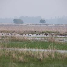
  3. Landscape image of the Kazhuveli Bird Sanctuary
    Landscape image of the Kazhuveli Bird Sanctuary
    A flock of Greater Flamingo flying around the Kazhuveli Bird Sanctuary
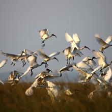
    A flock of Black-headed Ibis flying in the Kazhuveli Bird Sanctuary
    Golden Jackal found in Kazhuveli Bird Sanctuary
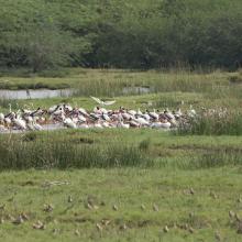
    Flock of Spot-billed Pelican resting on the bund in Kazhuveli Bird Sanctuary
    Flock of Painted Stork and Egrets foraging in the Kazhuveli Bird Sanctuary
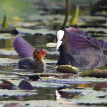
    Eurasian Coot with its juvenile
    Painted Stork in Kazhuveli Bird Sanctuary

    Kazhuveli Bird Sanctuary

    • Pays: 
      Inde
    • Date d’inscription: 
      16-01-2024
    • Numéro du site: 
      2548
    • Publié depuis: 
      0 year(s)
    5'152 ha
  4. Flocks of birds at Tuckerbil Swamp near Leeton
    Brolgas at Tuckerbil Swamp
    Wading birds at Fivebough Swamp
    Reed vegetation at Tuckerbil Swamp
    Reed vegetation at Fivebough Swamp

    Fivebough and Tuckerbil Swamps

    • Pays: 
      Australie
    • Date d’inscription: 
      21-10-2002
    • Numéro du site: 
      1224
    • Publié depuis: 
      0 year(s)
    619 ha
  5. Mahanga (within Banyini Pan)
    Mahanga (within Banyini Pan)
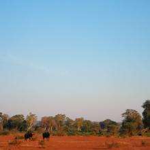
    Luvuvhu and Limpopo River confluence at Crook's Corner
    Mambvumbvanyi Pan
    Mapimbana Pan
    Nwambi Pan
    Nwambi Pan (dry season)
    Luvuvhu River floodplain
    Xagova Pan
    Nghila Pan
    University of Venda scientists explaining pan ecological character to members of the Makuleke Communal Property Association and Ministry officials (DFFE) at Hapi Pan
    The Luvuvhu River flowing through the Lanner Gorge before entering the Makuleke Ramsar site floodplains
    The Luvuvhu River floodplain during the dry season
    fever tree forest at Gwalala
    dry season game utilization of the floodplain
    in-field discussions with elders of the Makuleke community on how they utilised the resources of the pans before their forceful removal from the land in the 1960s

    Makuleke Wetlands

    • Pays: 
      Afrique du Sud
    • Date d’inscription: 
      22-05-2007
    • Numéro du site: 
      1687
    • Publié depuis: 
      0 year(s)
    10'799 ha
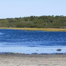
  6. The Ramsar listed wetland of Jocks Lagoon near St Helens in Tasmania
    The Ramsar listed wetland of Jocks Lagoon near St Helens in Tasmania
    The Ramsar listed wetland of Jocks Lagoon near St Helens in Tasmania
    The Ramsar listed wetland of Jocks Lagoon near St Helens in Tasmania

    Jocks Lagoon

    • Pays: 
      Australie
    • Date d’inscription: 
      16-11-1982
    • Numéro du site: 
      258
    • Publié depuis: 
      0 year(s)
    19 ha
  7. Bowling Green Bay
    Date unknown. Bowling Green Bay is characterised by coastal plain covered in tidal mudflats, mangrove forest and salt marshes (Photo DEWHA)
    Date unknown. Cape Cleveland at low tide (Photo DEWHA).
    Date unknown. The Haughton River flows 5-6 months of the year into Bowling Green Bay (Photo DEWHA).

    Bowling Green Bay

    • Pays: 
      Australie
    • Date d’inscription: 
      22-10-1993
    • Numéro du site: 
      632
    • Publié depuis: 
      0 year(s)
    36'652 ha
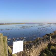
  8. View of All Fleets Marsh
    View up the River Crouch from Brandy Hole
    View of Brandy Hole

    Crouch & Roach Estuaries

    • Pays: 
      Royaume-Uni de Grande-Bretagne et d'Irlande du Nord
    • Date d’inscription: 
      24-03-1995
    • Numéro du site: 
      721
    • Publié depuis: 
      0 year(s)
    1'848 ha
  9. Bar-headed goose (Anser indicus)
    Landscape of Sichuan Changshagongma

    Sichuan Changshagongma Wetlands

    • Pays: 
      Chine
    • Date d’inscription: 
      08-01-2018
    • Numéro du site: 
      2348
    • Publié depuis: 
      0 year(s)
    669'800 ha
  10. Cap des Trois Fourches
    Cap des Trois Fourches
    Cap des Trois Fourches

    Cap des Trois Fourches

    • Pays: 
      Maroc
    • Date d’inscription: 
      15-01-2005
    • Numéro du site: 
      1473
    • Publié depuis: 
      0 year(s)
    5'640 ha

Pages

Stats


Exports

Exportation d’informations sur les Sites Ramsar

Pour une liste résumée de tous les Sites Ramsar en format pdf, cliquez ici.

Générer des rapports sur un choix de Sites Ramsar

Vous pouvez générer un rapport à partir des filtres choisis, soit en pdf, soit en xls. Le rapport classera les résultats par noms de sites à moins que vous n’ayez choisi une autre variable de tri.

Pour les pdf, vous pouvez choisir d’inclure le texte d’introduction de chaque site ou seulement les données principales dans un rapport plus court.

Afin de recevoir la liste des sites Ramsar que vous avez sélectionnés, veuillez SVP nous fournir votre courriel et entrer le texte que vous voyez dans l'image de vérification dans la zone de texte.

Une foi la liste créée, un courriel vous sera envoyé contenant le lien pour accéder au fichier. Cela ne devrait pas prendre plus de 10 minutes.