Résultats de la recherche

Carte

Choisir carte: | | Téléchargement Centroids / Boundaries / Carte (pdf)
Le matériel présenté sur ce site web, et en particulier les cartes et l’information territoriale, est tel qu’il apparaît dans les données disponibles et n’implique en aucune manière l’expression d’une opinion quelconque de la part du Secrétariat de la Convention de Ramsar concernant le statut juridique de tout pays, territoire, ville ou zone, ou de ses autorités, ou concernant la délimitation de ses frontières ou limites.

Liste

  1. Ramsar logo

    Área de Protección de Flora y Fauna Cuatrociénegas

    • Pays: 
      Mexique
    • Date d’inscription: 
      22-06-1995
    • Numéro du site: 
      734
    • Publié depuis: 
      23 year(s)
    84'347 ha
  2. Ramsar logo

    Tateyama Midagahara and Dainichidaira

    • Pays: 
      Japon
    • Date d’inscription: 
      03-07-2012
    • Numéro du site: 
      2059
    • Publié depuis: 
      13 year(s)
    574 ha
  3. Ramsar logo

    Nemrut Caldera

    • Pays: 
      Türkiye
    • Date d’inscription: 
      17-04-2013
    • Numéro du site: 
      2145
    • Publié depuis: 
      12 year(s)
    4'589 ha
  4. Ramsar logo

    Wilder Kaiser

    • Pays: 
      Autriche
    • Date d’inscription: 
      08-04-2013
    • Numéro du site: 
      2146
    • Publié depuis: 
      12 year(s)
    3'781 ha
  5. Ave Eudocimus albus presente en la ciénega de San Juan al norte del sitio Ramsar
    Ave Calidris minutilla en laguna intermitente Casa Colorada
    Ave Calidris minutilla en laguna intermitente Casa Colorada
    Ave Calidris himantopus en laguna intermitente Casa Colorada
    Ave Limodromus griseus y Calidris minutilla
    Aves en el Lago Artificial Nabor Carrillo
    Ave 
 y Anas acuta en el Lago Artificial Nabor Carrillo
    Ciénega Intermitente
    Aves Anas diazi en Ciénega Intermitente
    Ave Cynathus auriceps en Ciénega Intermitente Texcoco Norte
    Ave Himantopus mexicanus y Calidris minutilla en Ciénega Casa Colorada

    Lago de Texcoco

    • Pays: 
      Mexique
    • Date d’inscription: 
      05-06-2022
    • Numéro du site: 
      2469
    • Publié depuis: 
      2 year(s)
    10'077 ha
  6. Prut river flow start
    Shrubed peat-bog
    Spurce virgin wet/dry forests
    Stream running through peat bog
    View on Tsybulnyk forested/shurbed peat bog
    A post-glacial kettle under Mount Turkul with the alpine lake Nesamovyte
    A rivulet in the boggy cirque between the mounts of Hoverla and Breskul
    A sedge-moss bog “Tsybulnyk” under Mount Breskul

    Prut River Headwaters

    • Pays: 
      Ukraine
    • Date d’inscription: 
      20-03-2019
    • Numéro du site: 
      2395
    • Publié depuis: 
      5 year(s)
    4'935 ha
  7. Image of the swamp in the Longwood Shola Reserve Forest
    Image of the swamp in the Longwood Shola Reserve Forest
    Image of the swamp in the Longwood Shola Reserve Forest
    Image of the swamp in the Longwood Shola Reserve Forest
    Image of the steam reaching a swamp in the Longwood Shola Reserve Forest
    Image of the steam in the Longwood Shola Reserve Forest
    Image of the swamp in the Longwood Shola Reserve Forest
    Image of the swamp in the Longwood Shola Reserve Forest

    Longwood Shola Reserve Forest

    • Pays: 
      Inde
    • Date d’inscription: 
      24-05-2023
    • Numéro du site: 
      2538
    • Publié depuis: 
      1 year(s)
    116 ha
  8. aerial view Lake nakuru showing submerged roads after lake water level rise
    Flamingos in Lake Nakuru in the background
    Aerial view of Lake Nakuru
    Flamingos in Lake Nakuru in the background

    Lake Nakuru

    • Pays: 
      Kenya
    • Date d’inscription: 
      05-06-1990
    • Numéro du site: 
      476
    • Publié depuis: 
      1 year(s)
    18'800 ha
  9. Lago de Yojoa
    Lago de Yojoa
    Lago de Yojoa

    Cuenca del Lago de Yojoa

    • Pays: 
      Honduras
    • Date d’inscription: 
      05-06-2005
    • Numéro du site: 
      1467
    • Publié depuis: 
      3 year(s)
    44'254 ha
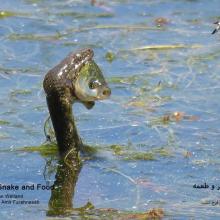
  10. Natrix tessellata hunting fish in Gandoman wetland
    Gandoman Wetland
    Phoenicopterus roseus in Gandoman wetland
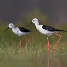
    Himantopus himantopus in Gandoman wetland
    Phalacrocorax carbo in Gandoman wetland
    Vanellus spinosus in Gandoman wetland
    Ardeola ralloides in Gandoman wetland
    Egretta garzetta in Gandoman wetland.
    Himantopus himantopus in Gandoman wetland.
    Podiceps nigricollis in Gandoman wetland.
    Fire Fighting station and Ranger station in Gandoman wetland.
    Bird watching tower in Gandoman wetland.
    Online Surveillance Camera in Gandoman wetland.
    Fulica atra in Gandoman wetland.
    Ciconia ciconia in Gandoman wetland.

    Gandoman

    • Pays: 
      Iran (République islamique d')
    • Date d’inscription: 
      21-07-2024
    • Numéro du site: 
      2558
    • Publié depuis: 
      0 year(s)
    1'070 ha

Pages

Stats


Exports

Exportation d’informations sur les Sites Ramsar

Pour une liste résumée de tous les Sites Ramsar en format pdf, cliquez ici.

Générer des rapports sur un choix de Sites Ramsar

Vous pouvez générer un rapport à partir des filtres choisis, soit en pdf, soit en xls. Le rapport classera les résultats par noms de sites à moins que vous n’ayez choisi une autre variable de tri.

Pour les pdf, vous pouvez choisir d’inclure le texte d’introduction de chaque site ou seulement les données principales dans un rapport plus court.

Afin de recevoir la liste des sites Ramsar que vous avez sélectionnés, veuillez SVP nous fournir votre courriel et entrer le texte que vous voyez dans l'image de vérification dans la zone de texte.

Une foi la liste créée, un courriel vous sera envoyé contenant le lien pour accéder au fichier. Cela ne devrait pas prendre plus de 10 minutes.