Resultados de la búsqueda

Mapa

Elegir mapa: | | Descargar Centroids / Boundaries / Mapa (pdf)
Los materiales presentados en este sitio web, particularmente los mapas y la información territorial, se proporcionan tal cual y según están disponibles a partir de los datos de los que se dispone y no implican la expresión de opinión alguna por parte de la Secretaría de la Convención de Ramsar respecto de la condición jurídica de ningún país, territorio, ciudad o zona, ni de sus autoridades, ni respecto de la delimitación de sus límites o fronteras.

Lista

  1. Typical reservoir of the site Unterer Inn with the different stages of succession to alluvial forests
    Extensive redynamisation measures are currently underway on the Lower Inn. At the Ering power plant, for example, reinforced river embankments were removed in recent years and a new island tributary system with shallow gravel banks was created.
    Numerous migratory birds rest on the mudflats and shallow siltation zones in the reservoirs on the Lower Inn, especially in autumn, to replenish their reserves before embarking on their strenuous flight over the Alps (here in the background).

    Lower Inn between Haiming and Neuhaus

    • País: 
      Alemania
    • Fecha de designación: 
      26-02-1976
    • Número del sitio: 
      96
    • Publicado hace: 
      0 year(s)
    1,846 ha
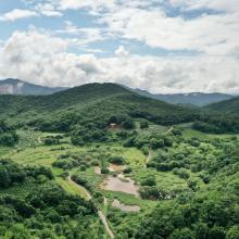
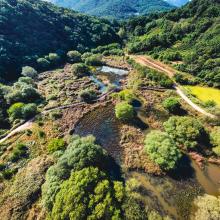
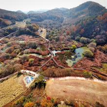
  2. Mungyeong Doline Wetland formed in a doline area, which is rare for wetlands
    Mungyeong Doline Wetland with colorful rice paddy
    Mungyeong Doline Wetland with colorful trees in autumn

    Mungyeong Doline Wetland

    • País: 
      República de Corea
    • Fecha de designación: 
      02-02-2024
    • Número del sitio: 
      2540
    • Publicado hace: 
      1 year(s)
    49 ha
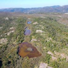
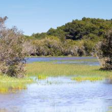
  3. Vue aérienne de la Réserve Naturelle des Tre Padule de Suartone
    Vue de la mare de Tre Padule Est
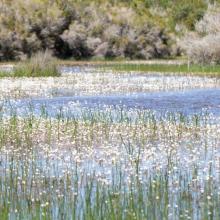
    Vue de Ranunculus peltatus au premier plan de la mare de Padule Maggiore
    Vue du plateau de Campu celi et de trois mares temporaires de la réserve naturelle
    Mare de Tre Padule Est en phase inondée
    Vue aérienne des Tre Paduli
    Ruisseau temporaire de Campu Celi
    Mare de Tre Padule Est au printemps
    Végétation de la mare en phase inondée
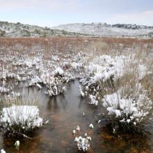
    Mare de Tre Padule Est en hiver
    Padule Maggiore sous la neige

    Mares temporaires de Tre Padule de Suartone

    • País: 
      Francia
    • Fecha de designación: 
      02-02-2007
    • Número del sitio: 
      1651
    • Publicado hace: 
      2 year(s)
    218 ha
  4. Aerial view of the Pitt Water-Orielton Lagoon Ramsar Site. Photo by Jim Mollison. Date unknown.
    Orielton Lagoon Nature Reserve, Sorell Tasmania. Photo by Michelle McAulay. Date unknown.
    Pitt Water, near MC Gees Bridge. Photo by Michelle McAulay. Date unknown.

    Pitt Water-Orielton Lagoon

    • País: 
      Australia
    • Fecha de designación: 
      16-11-1982
    • Número del sitio: 
      254
    • Publicado hace: 
      1 year(s)
    3,334 ha
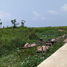
  5. Ebute Oni Coastal Wetland
    Ebute Oni Coastal Wetland
    Ebute Oni Coastal Wetland
    Ebute Oni Coastal wetland

    Ebute Oni coastal Wetland

    • País: 
      Nigeria
    • Fecha de designación: 
      01-03-2024
    • Número del sitio: 
      2564
    • Publicado hace: 
      0 year(s)
    103 ha
  6. A view of Iyake Lake
    Entrance of Ado hill

    Ado-Awaye (Iyake) Suspended Lake Wetland

    • País: 
      Nigeria
    • Fecha de designación: 
      01-03-2024
    • Número del sitio: 
      2550
    • Publicado hace: 
      0 year(s)
    165 ha
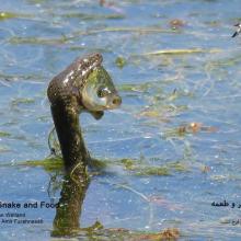
  7. Natrix tessellata hunting fish in Gandoman wetland
    Gandoman Wetland
    Phoenicopterus roseus in Gandoman wetland
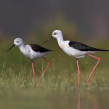
    Himantopus himantopus in Gandoman wetland
    Phalacrocorax carbo in Gandoman wetland
    Vanellus spinosus in Gandoman wetland
    Ardeola ralloides in Gandoman wetland
    Egretta garzetta in Gandoman wetland.
    Himantopus himantopus in Gandoman wetland.
    Podiceps nigricollis in Gandoman wetland.
    Fire Fighting station and Ranger station in Gandoman wetland.
    Bird watching tower in Gandoman wetland.
    Online Surveillance Camera in Gandoman wetland.
    Fulica atra in Gandoman wetland.
    Ciconia ciconia in Gandoman wetland.

    Gandoman

    • País: 
      Irán (República Islámica del)
    • Fecha de designación: 
      21-07-2024
    • Número del sitio: 
      2558
    • Publicado hace: 
      0 year(s)
    1,070 ha
  8. Delta of the river Ache in nature protection area of lake Chiemsee
    Lake Chiemsee
    View from the village of „Übersee“ and the half-island „Lachsgang“ to north-east in direction of the protected area „Achendelta“.
    View from the village of „Übersee“ and the half-island „Lachsgang“ to north-east in direction of the protected area „Achendelta“.

    Lake Chiemsee

    • País: 
      Alemania
    • Fecha de designación: 
      26-02-1976
    • Número del sitio: 
      95
    • Publicado hace: 
      1 year(s)
    8,231 ha
  9. Aerial view showing areas of exposed rock and sandy gullies within the South East Coast of Jersey Ramsar site with pacific oyster beds in the foreground
    View of the exposed intertidal habitats within the South East Coast of Jersey Ramsar site
    View of Seymour Tower – this was built in 1782 as a coastal defence tower and is located just inside the boundary of South East Coast of Jersey Ramsar site – the site stretches back to the coastline of Jersey island which is visible in the background

    South East Coast of Jersey, Channel Islands

    • País: 
      Reino Unido de Gran Bretaña e Irlanda del Norte (Crown dependencies)
    • Fecha de designación: 
      10-11-2000
    • Número del sitio: 
      1043
    • Publicado hace: 
      1 year(s)
    3,142 ha
  10. Owabi Wildlife Sanctuary and Ramsar Site
    Owabi Wildlife Sanctuary and Ramsar Site
    Owabi Wildlife Sanctuary and Ramsar Site
    Owabi Wildlife Sanctuary and Ramsar Site
    Owabi Wildlife Sanctuary and Ramsar Site
    Owabi Wildlife Sanctuary and Ramsar Site

    Owabi Wildlife Sanctuary Ramsar Site

    • País: 
      Ghana
    • Fecha de designación: 
      22-02-1988
    • Número del sitio: 
      393
    • Publicado hace: 
      1 year(s)
    1,310 ha

Páginas

Stats


Exportaciones

Exportar información sobre sitios

Para obtener una lista resumida en formato pdf de todos los sitios Ramsar, por favor hacer clic aqui.

Generar informes de sitios seleccionados

Se puede generar un informe según los filtros que se hayan aplicado, ya sea en formato pdf o xls. El informe ordena los resultados por nombre de sitio, a menos que se hayan clasificado por otra variable.

Para los archivos en formato pdf, se puede elegir si se desea incluir el texto de introducción sobre cada sitio, o si simplemente se desea mostrar los datos principales en un informe más corto.

Para recibir la lista de Sitios Ramsar que ha seleccionado en un archivo de Microsoft Excel, por favor proporcione su dirección de correo electrónico e introduzca en el recuadro el texto que ve en la imagen de verificación.

Tan pronto como la lista sea generada, recibirá un correo electrónico con el vínculo para acceder al archivo. Este proceso no debe tardar más de 10 minutos.