Resultados de la búsqueda

Mapa

Elegir mapa: | | Descargar Centroids / Boundaries / Mapa (pdf)
Los materiales presentados en este sitio web, particularmente los mapas y la información territorial, se proporcionan tal cual y según están disponibles a partir de los datos de los que se dispone y no implican la expresión de opinión alguna por parte de la Secretaría de la Convención de Ramsar respecto de la condición jurídica de ningún país, territorio, ciudad o zona, ni de sus autoridades, ni respecto de la delimitación de sus límites o fronteras.

Lista

  1. Complexe du bas Tahaddart
    Complexe du bas Tahaddart
    Complexe du bas Tahaddart
    Complexe du bas Tahaddart

    Complexe du bas Tahaddart

    • País: 
      Marruecos
    • Fecha de designación: 
      15-01-2005
    • Número del sitio: 
      1476
    • Publicado hace: 
      0 year(s)
    10,690 ha
  2. View of Gouliot Headland from the western end
    View of the spectacular ‘Jewel Cave’ at low tide

    Gouliot Caves and Headland, Sark

    • País: 
      Reino Unido de Gran Bretaña e Irlanda del Norte (Crown dependencies)
    • Fecha de designación: 
      09-04-2007
    • Número del sitio: 
      2276
    • Publicado hace: 
      1 year(s)
    4 ha
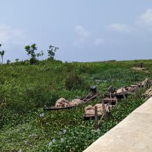
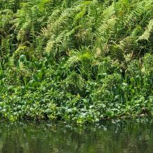
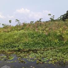
  3. Ebute Oni Coastal Wetland
    Ebute Oni Coastal Wetland
    Ebute Oni Coastal Wetland
    Ebute Oni Coastal wetland

    Ebute Oni coastal Wetland

    • País: 
      Nigeria
    • Fecha de designación: 
      01-03-2024
    • Número del sitio: 
      2564
    • Publicado hace: 
      0 year(s)
    103 ha
  4. A view of Iyake Lake
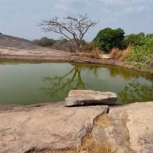
    Entrance of Ado hill

    Ado-Awaye (Iyake) Suspended Lake Wetland

    • País: 
      Nigeria
    • Fecha de designación: 
      01-03-2024
    • Número del sitio: 
      2550
    • Publicado hace: 
      0 year(s)
    165 ha
  5. A view of Arinta Waterfall
    A view of Arinta Waterfall
    Entrance to Arinta Waterfall
    Vegetation around Arinta Waterfall

    Arinta Waterfall

    • País: 
      Nigeria
    • Fecha de designación: 
      01-03-2024
    • Número del sitio: 
      2565
    • Publicado hace: 
      0 year(s)
    181 ha
  6. Delta of the river Ache in nature protection area of lake Chiemsee
    Lake Chiemsee
    View from the village of „Übersee“ and the half-island „Lachsgang“ to north-east in direction of the protected area „Achendelta“.
    View from the village of „Übersee“ and the half-island „Lachsgang“ to north-east in direction of the protected area „Achendelta“.

    Lake Chiemsee

    • País: 
      Alemania
    • Fecha de designación: 
      26-02-1976
    • Número del sitio: 
      95
    • Publicado hace: 
      1 year(s)
    8,231 ha
  7. Sudochye lake system
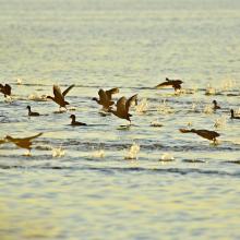
    Common Moorhen on the Ramsar site

    Sudochye lake system

    • País: 
      Uzbekistán
    • Fecha de designación: 
      30-05-2022
    • Número del sitio: 
      2522
    • Publicado hace: 
      1 year(s)
    84,000 ha
  8. Mangroves near Shannah
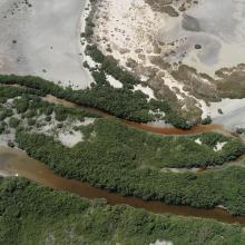
    Mangroves near Shannah
    Intertidal mudflats near Shannah
    Mahout Island
    Filim salt flat
    Kinasah lagoon
    Abb Island
    Kinasah lagoon
    Intertidal mudflats

    Wetlands Reserve in Al Wusta Governorate

    • País: 
      Omán
    • Fecha de designación: 
      25-10-2023
    • Número del sitio: 
      2529
    • Publicado hace: 
      1 year(s)
    213,715 ha
  9. Northeast part of the lake. Open water, green algae and diving duck species are visible.
    waterbird habitat in Pyu Lake
    waterbird habitat in Pyu Lake
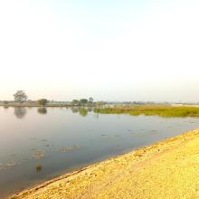
    Eastern part of Pyu Lake during dry season. Open water with algae and tall grasses are visible.
    Southern part of the Lake during rainy season
    Southern part of the Lake. Stands of reed mace and tall grasses with few waterbirds are visible.
    Northern part of the Lake. Open water with green algae visible.
    East to west part of the Lake Visible. Area with open water where villagers bathe and wash clothes during dry season.

    Pyu Lake

    • País: 
      Myanmar
    • Fecha de designación: 
      02-02-2024
    • Número del sitio: 
      2533
    • Publicado hace: 
      1 year(s)
    234 ha
  10. North of lake Ammersee with Ampermoos
    South of lake Ammersee with the Natura 2000 area "Ammersee south shore and Raistinger meadows" and the nature reserve "Vogelfreistätte Ammersee Süd"
    View from the observation site at the western dike of the new Ammer across the so-called Binnensee to the Dießen Minster. Core area for wetland birds with shallow water zones, reed beds and a nesting raft for Common Terns. In the foreground, siltation zone resulting from the bursting of a dam at the
    Downstream area dammed by a beaver in the Ampermoos, the large river valley fen north of Lake Ammer

    Lake Ammer

    • País: 
      Alemania
    • Fecha de designación: 
      26-02-1976
    • Número del sitio: 
      93
    • Publicado hace: 
      1 year(s)
    6,386 ha

Páginas

Stats


Exportaciones

Exportar información sobre sitios

Para obtener una lista resumida en formato pdf de todos los sitios Ramsar, por favor hacer clic aqui.

Generar informes de sitios seleccionados

Se puede generar un informe según los filtros que se hayan aplicado, ya sea en formato pdf o xls. El informe ordena los resultados por nombre de sitio, a menos que se hayan clasificado por otra variable.

Para los archivos en formato pdf, se puede elegir si se desea incluir el texto de introducción sobre cada sitio, o si simplemente se desea mostrar los datos principales en un informe más corto.

Para recibir la lista de Sitios Ramsar que ha seleccionado en un archivo de Microsoft Excel, por favor proporcione su dirección de correo electrónico e introduzca en el recuadro el texto que ve en la imagen de verificación.

Tan pronto como la lista sea generada, recibirá un correo electrónico con el vínculo para acceder al archivo. Este proceso no debe tardar más de 10 minutos.