Resultados de la búsqueda

Mapa

Elegir mapa: | | Descargar Centroids / Boundaries / Mapa (pdf)
Los materiales presentados en este sitio web, particularmente los mapas y la información territorial, se proporcionan tal cual y según están disponibles a partir de los datos de los que se dispone y no implican la expresión de opinión alguna por parte de la Secretaría de la Convención de Ramsar respecto de la condición jurídica de ningún país, territorio, ciudad o zona, ni de sus autoridades, ni respecto de la delimitación de sus límites o fronteras.

Lista

  1. The San Nicolas Bay Reef islands in the back are breeding habitat for thousands of terns from 10 species.
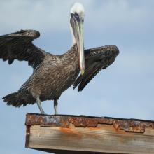
    Brown Pelican at San Nicolas Bay
    One of the turtle nesting beaches in front and the harbour area at San Nicolas in the back.
    Caribbean Blue Tang (Acanthurus coeruleus) and Black sea rod (Plexaura homomalla).
    Queen conch (Strombus gigas)
    Cayenne tern (Thalasseus eurygnathus and Cabot's tern (Thalasseus acuflavidus).
    Cayenne tern (Thalasseus eurygnathus.
    Green turtle (Chelonia mydas).
    Fresh water pond Fontein.

    East Point

    • País: 
      Países Bajos (Reino de los) (Aruba)
    • Fecha de designación: 
      10-11-2023
    • Número del sitio: 
      2525
    • Publicado hace: 
      1 year(s)
    7,597 ha
  2. Rules and regulations at the entrance of one of the site's beaches.
    The site encompasses Aruba's largest stand of mangrove forest.
    The tangle of mangrove trees and branches protects the coast from extreme weather events.
    One of the islets that is part of a chain of islands in front of the coast.
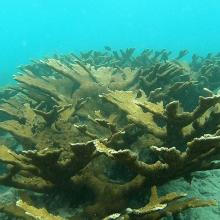
    Elhorn coral) Acropora palmata)
    Honeycomb cowfish (Acanthostracion polygonius) in sea grass beds (Thalassia testudinum and Zyringodium filiforme).
    False killer-whale (Pseudorca crassidens).
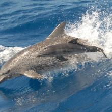
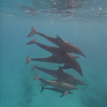
    The Atlantic spotted dolphin (Stenella frontalis) uses the site for refuge, birthing and nursery.
    The Rough-toothed dolphin (Steno bredanensis) uses the site for refuge, birthing and nursery.
    Several dolphin species, like Tursiops truncatus, can be observed close to the coast.

    South Coast

    • País: 
      Países Bajos (Reino de los) (Aruba)
    • Fecha de designación: 
      10-11-2023
    • Número del sitio: 
      2526
    • Publicado hace: 
      1 year(s)
    3,975 ha
  3. Sunset at Nagi
    Osprey
    Pied Kingfisher
    Common Pochard

    Nagi Bird Sanctuary

    • País: 
      India
    • Fecha de designación: 
      11-10-2023
    • Número del sitio: 
      2545
    • Publicado hace: 
      1 year(s)
    206 ha
  4. Swans in Hyo-ko, cherry blossoms, and Gozu mountain range with remaining snow
    Flying for commuting
    Hyo-ko in a fine clear day
    Hyo-ko at sunrise

    Hyo-ko

    • País: 
      Japón
    • Fecha de designación: 
      30-10-2008
    • Número del sitio: 
      1842
    • Publicado hace: 
      1 year(s)
    24 ha
  5. Edithvale South Wetland

    Edithvale-Seaford Wetlands

    • País: 
      Australia
    • Fecha de designación: 
      29-08-2001
    • Número del sitio: 
      1096
    • Publicado hace: 
      1 year(s)
    261 ha
  6. North of lake Ammersee with Ampermoos
    South of lake Ammersee with the Natura 2000 area "Ammersee south shore and Raistinger meadows" and the nature reserve "Vogelfreistätte Ammersee Süd"
    View from the observation site at the western dike of the new Ammer across the so-called Binnensee to the Dießen Minster. Core area for wetland birds with shallow water zones, reed beds and a nesting raft for Common Terns. In the foreground, siltation zone resulting from the bursting of a dam at the
    Downstream area dammed by a beaver in the Ampermoos, the large river valley fen north of Lake Ammer

    Lake Ammer

    • País: 
      Alemania
    • Fecha de designación: 
      26-02-1976
    • Número del sitio: 
      93
    • Publicado hace: 
      1 year(s)
    6,386 ha
  7. Aerial view of Lake Galenbeck

    Lake Galenbeck

    • País: 
      Alemania
    • Fecha de designación: 
      31-07-1978
    • Número del sitio: 
      177
    • Publicado hace: 
      1 year(s)
    1,040 ha
  8. Ostufer der Müritz Luftbild
    Ostufer der Müritz

    Eastern shore of Lake Müritz

    • País: 
      Alemania
    • Fecha de designación: 
      31-07-1978
    • Número del sitio: 
      172
    • Publicado hace: 
      1 year(s)
    4,974 ha
  9. Danube marshy river banks
    Kovilovo
    Kovilovo
    Kovilovo
    Kovilovo
    Mali Strbac
    Ploce
    Sokolovac
    Sokolovac

    Djerdap

    • País: 
      Serbia
    • Fecha de designación: 
      08-06-2020
    • Número del sitio: 
      2442
    • Publicado hace: 
      4 year(s)
    66,525 ha
  10. Bar headed goose in Magadi kere wetland
    Panoramic view of Magadi kere
    Panoramic view of Magadi kere

    Magadi Kere Conservation Reserve

    • País: 
      India
    • Fecha de designación: 
      14-02-2023
    • Número del sitio: 
      2536
    • Publicado hace: 
      1 year(s)
    54 ha

Páginas

Stats


Exportaciones

Exportar información sobre sitios

Para obtener una lista resumida en formato pdf de todos los sitios Ramsar, por favor hacer clic aqui.

Generar informes de sitios seleccionados

Se puede generar un informe según los filtros que se hayan aplicado, ya sea en formato pdf o xls. El informe ordena los resultados por nombre de sitio, a menos que se hayan clasificado por otra variable.

Para los archivos en formato pdf, se puede elegir si se desea incluir el texto de introducción sobre cada sitio, o si simplemente se desea mostrar los datos principales en un informe más corto.

Para recibir la lista de Sitios Ramsar que ha seleccionado en un archivo de Microsoft Excel, por favor proporcione su dirección de correo electrónico e introduzca en el recuadro el texto que ve en la imagen de verificación.

Tan pronto como la lista sea generada, recibirá un correo electrónico con el vínculo para acceder al archivo. Este proceso no debe tardar más de 10 minutos.