Resultados de la búsqueda

Mapa

Elegir mapa: | | Descargar Centroids / Boundaries / Mapa (pdf)
Los materiales presentados en este sitio web, particularmente los mapas y la información territorial, se proporcionan tal cual y según están disponibles a partir de los datos de los que se dispone y no implican la expresión de opinión alguna por parte de la Secretaría de la Convención de Ramsar respecto de la condición jurídica de ningún país, territorio, ciudad o zona, ni de sus autoridades, ni respecto de la delimitación de sus límites o fronteras.

Lista

  1. Lake Shkodra and River Buna Ramsar Site
    Lake Shkodra and River Buna Ramsar Site
    Lake Shkodra and River Buna Ramsar Site

    Lake Shkodra and River Buna

    • País: 
      Albania
    • Fecha de designación: 
      02-02-2006
    • Número del sitio: 
      1598
    • Publicado hace: 
      19 year(s)
    49,562 ha
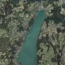
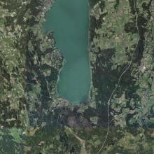
  2. Resting birds round the Roseninsel in the northern part of lake Starnberg
    Northern part of lake Starnberg
    Southern part of lake Starnberg

    Lake Starnberg

    • País: 
      Alemania
    • Fecha de designación: 
      26-02-1976
    • Número del sitio: 
      94
    • Publicado hace: 
      0 year(s)
    5,652 ha
  3. "Hochrunstfilze" aerial view
    watchtower in the "Kollerfilze"
    "Kollerfilze" view
    bog restoration in the "Hochrunstfilze"
    dragonfly
    "Kollerfilze" view
    Northern Lapwing
    dragonfly
    dragonfly
    "Kollerfilze" view
    Sphagnum
    European Stonechat
    Black Stork
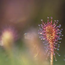
    Drosera
    Eriophorum
    Eriophorum
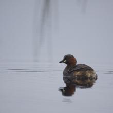
    Little Grebe
    "Moorstation Nicklheim"
    "Moorstation Nicklheim"
    bog restoration in the "Hochrunstfilze"

    Rosenheim Basin Bogs

    • País: 
      Alemania
    • Fecha de designación: 
      07-12-2020
    • Número del sitio: 
      2444
    • Publicado hace: 
      4 year(s)
    1,039 ha
  4. Aerial view of Bayerische Wildalm
    Bavarian Wildalm, Bavarian part
    Bavarian Wildalm and Wildalm Filz with a view of Halserspitz

    Bavarian Wildalm

    • País: 
      Alemania
    • Fecha de designación: 
      09-10-2007
    • Número del sitio: 
      1723
    • Publicado hace: 
      0 year(s)
    6 ha
  5. Feuchtbiotop Donaumoos
    Nasswiese südwestlich NSG Leipheimer Moos

    Donauauen & Donaumoos

    • País: 
      Alemania
    • Fecha de designación: 
      26-02-1976
    • Número del sitio: 
      90
    • Publicado hace: 
      0 year(s)
    7,067 ha
  6. Typical reservoir of the site Unterer Inn with the different stages of succession to alluvial forests
    Extensive redynamisation measures are currently underway on the Lower Inn. At the Ering power plant, for example, reinforced river embankments were removed in recent years and a new island tributary system with shallow gravel banks was created.
    Numerous migratory birds rest on the mudflats and shallow siltation zones in the reservoirs on the Lower Inn, especially in autumn, to replenish their reserves before embarking on their strenuous flight over the Alps (here in the background).

    Lower Inn between Haiming and Neuhaus

    • País: 
      Alemania
    • Fecha de designación: 
      26-02-1976
    • Número del sitio: 
      96
    • Publicado hace: 
      0 year(s)
    1,846 ha
  7. Delta of the river Ache in nature protection area of lake Chiemsee
    Lake Chiemsee
    View from the village of „Übersee“ and the half-island „Lachsgang“ to north-east in direction of the protected area „Achendelta“.
    View from the village of „Übersee“ and the half-island „Lachsgang“ to north-east in direction of the protected area „Achendelta“.

    Lake Chiemsee

    • País: 
      Alemania
    • Fecha de designación: 
      26-02-1976
    • Número del sitio: 
      95
    • Publicado hace: 
      1 year(s)
    8,231 ha
  8. Aerial view of Lake Galenbeck

    Lake Galenbeck

    • País: 
      Alemania
    • Fecha de designación: 
      31-07-1978
    • Número del sitio: 
      177
    • Publicado hace: 
      1 year(s)
    1,040 ha
  9. Ostufer der Müritz Luftbild
    Ostufer der Müritz

    Eastern shore of Lake Müritz

    • País: 
      Alemania
    • Fecha de designación: 
      31-07-1978
    • Número del sitio: 
      172
    • Publicado hace: 
      1 year(s)
    4,974 ha
  10. Glaver Koppel waterside in Winter
    View from the observation pulpit to the north over the Großer Werder in Krakow Upper Lake
    View from the Großer Werder to the Rauwerder in the Krakow Upper lake
    View to the southeast over the black-headed gull colony in the south of the Großer Werder in Krakow's Upper Lake

    Upper Lake Krakow

    • País: 
      Alemania
    • Fecha de designación: 
      31-07-1978
    • Número del sitio: 
      171
    • Publicado hace: 
      0 year(s)
    893 ha

Páginas

Stats


Exportaciones

Exportar información sobre sitios

Para obtener una lista resumida en formato pdf de todos los sitios Ramsar, por favor hacer clic aqui.

Generar informes de sitios seleccionados

Se puede generar un informe según los filtros que se hayan aplicado, ya sea en formato pdf o xls. El informe ordena los resultados por nombre de sitio, a menos que se hayan clasificado por otra variable.

Para los archivos en formato pdf, se puede elegir si se desea incluir el texto de introducción sobre cada sitio, o si simplemente se desea mostrar los datos principales en un informe más corto.

Para recibir la lista de Sitios Ramsar que ha seleccionado en un archivo de Microsoft Excel, por favor proporcione su dirección de correo electrónico e introduzca en el recuadro el texto que ve en la imagen de verificación.

Tan pronto como la lista sea generada, recibirá un correo electrónico con el vínculo para acceder al archivo. Este proceso no debe tardar más de 10 minutos.